![]() Japantown
Atlas - Southern California - Pasadena
Japantown
Atlas - Southern California - Pasadena
Overview Map: Central Pasadena: Japanese American Businesses in 1940
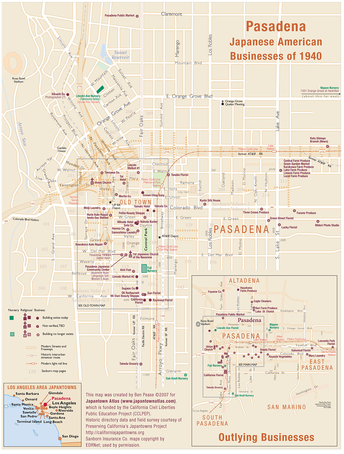
Pasadena was the first Overview Map in the Japantown Atlas. On this 2nd edition the outlying businesses are shown as an inset on the main Pasadena map.
Japanese American businesses were located along Fair Oaks Blvd, which was the main route into town from Los Angeles by road or rail, throughout Old Town and to some extent eastward along Colorado Blvd. Several historic Japanese American sites exist today on the west edge of downtown, but Old Town sites were demolished for the Hwy 134/ I-210/ I-710 interchange. The freeway planners used old rail routes as the first tear in the neighborhood fabric - east-west on the AT&SF main line (recently recycled as the Metro Gold Line light rail), and north-south along Union Pacific Railroad's branch to Pasadena and Altadena.
You can get a little bit of an idea of this neighborhood's late 19th/early 20th century architecture by wandering its remnant edges. Progress has gradually claimed other sites.
PCJ's Pasadena page has photos and history from their Pasadena surveys. We were delighted to find Lincoln Ave. Nursery still operating in 2007 (no longer Japanese American-owned, but in good hands).
See our detailed map of Old Town for a closer look at Fair Oaks and Colorado Blvds. as they were in the 1930s. As of July 2007 the map is shaping up. Some blocks are completely drawn with every building; others are outlined for later completion, but you can get a fairly good idea of how things were. Be forewarned it's an even BIGGER, oversized JPEG (the original is legal-sized and wouldn't reduce to 72 dpi).
If you have a decent internet connection, you may find it just as easy to view/download two-page PDF (600 kb), which you can view and zoom closer using Adobe Acrobat (small type will be crisper, too).
11/29/06, rev 7/26/07