![]() Japantown
Atlas - Central California - Fresno Chinatown (detail)
Japantown
Atlas - Central California - Fresno Chinatown (detail)
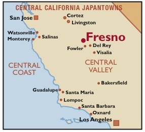

Fresno's Chinatown was a large and thriving Japanese American community in the 1910s and '20s. Despite the effects of California's Alien Land Laws, immigration restrictions, and the Great Depression, it was still a sizeable place in 1940. The map above shows the heart Chinatown, on Kern and Tulare Streets between E and G Streets. roughly as it appeared in 1940. The complete Fresno Chinatown map shows community institutions and small enterprises like clubs, churches and sewing schools scattered far to the south and west. Just east of the neighborhood, across the wide swath of railroad tracks, is the old Southern Pacific Railroad Depot. Fresno would have been a major transfer point between San Francisco, Los Angeles, and outyling Central Valley towns like Del Rey, Visalia, and Fowler.
The Fresno Outlying Areas map shows West Fresno JA landmarks plus half a dozen businesses on the east (or "white") side of the SP tracks. More photos.
A few of Chinatown's 1940s landmarks could still be seen in 2007 - the Nippon Buildings at Kern and F Streets, the building that housed Komoto's Department Store and Asia Hotel at Kern and G Streets, the Fresno Buddhist Temple at Kern and E Streets. But today's Japanese American businesses are fairly rare. We paid an tasty visit to Kogetsu-do Candy Store at 920 F Street, a 100-year old, 3rd-generation family buisness, and sampled their traditional manju pastries. We lunched at busy Central Fish Market, which carries on the grocery, fish, lunch counter, sundries, and tschotchke trade at Kern and G Streets (established just after WWII).
Other enterprises clinging to the neighborhood have closed as the owners have retired or passed away – we peered through the dusty windows of Aki Hardware and Komoto's Department Store. On the back side of Nippon Building #2, Nippon Hall was torn down years ago for a parking lot, but the exposed plaster on the rear brick walls of the remaining hotel and storefronts reveal a trace of the theater's sloped floor and balcony.
There are many holes in today's Chinatown. Besides the usual wear and tear and freeways, the city of Fresno has been active in purchasing and tearing down old, abandoned buildings. But the city and nonprofits such as Chinatown Revitalization Inc. have also put some energy into preserving what's left of this old working-class business district. The Bow On Building may be renovated as a community center. Fresno's own downtown has also been sucked dry by the suburbs; pedestrian malls and convention centers have helped a little, a minor league baseball stadium within sight of Chinatown is the biggest recent change that may bring people back ffrom the suburbs. It's a tough place to spark gentrification, but some sort of investment will be needed to ensure today's Chinese, Mexican, Italian, Armenian, and Japanese American businesses (plus the gritty residential hotels and the surrounding leafy neighorhoods) are a good place to live and do business.
Several years ago, the two Japanese American Christian churches merged and moved to Clovis/Fresno area, where most new middle class housing is occuring, and it appears to have been a good move for their congregation. Fresno Buddhist Temple has long debated a similar move, selling their old, stately home in favor of building anew on donated property in North Fresno.. This would be good for the church and the many congregants who live in the northern suburbs, but regrettable from an architectural and community heritage point of view. The current, 1922 building (below) has the disadvantage of the sanctuary being on the third floor with no elevator; (to accomodate elderly worshippers, most services have been held in the ground-floor Fellowship Hall, on the site of the old Congregational Church). If such a move happens, it would be important to find a respectful new owner for the old building.
Longtime resident Nori Masuda provided PCJ and Japantown Atlas
many details not shown on the Sanborn maps, in particular the sumo and judo
arenas and softball fields on the Buddhist Church block. Masuda's family lived
at several locations, including the center house just north of the sumo arena;
by 1940 they opened Masuda Drink Shop around the corner from the Ryan Theater.
1 2
2
3 4
4
5 6
6 
Notes:
The full Chinatown map includes a legend
explaining the building colors and notes. The 11x17 map is also available
for download as a PDF.